

Note: sometimes the daily temperature is not taken

Total number of Shore Station samples collected at Pacific Grove:

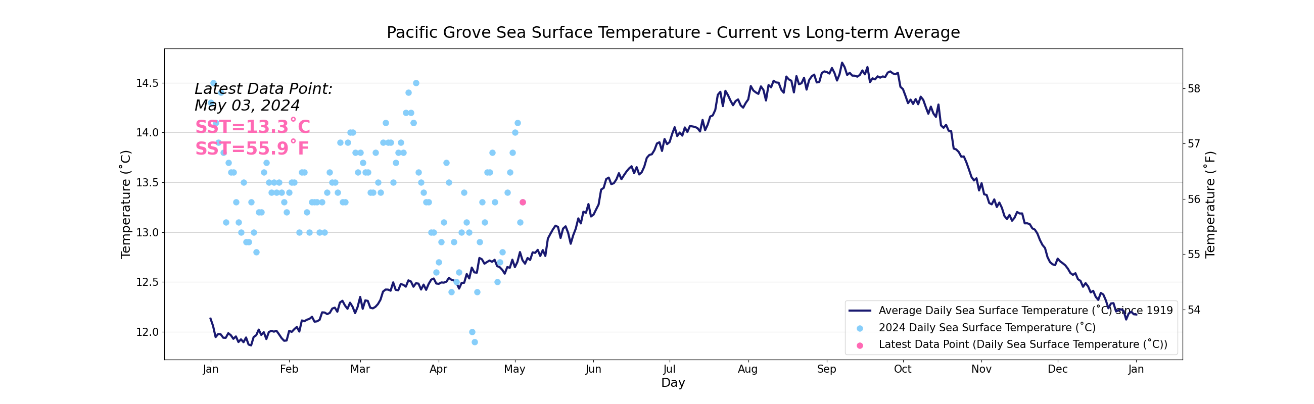
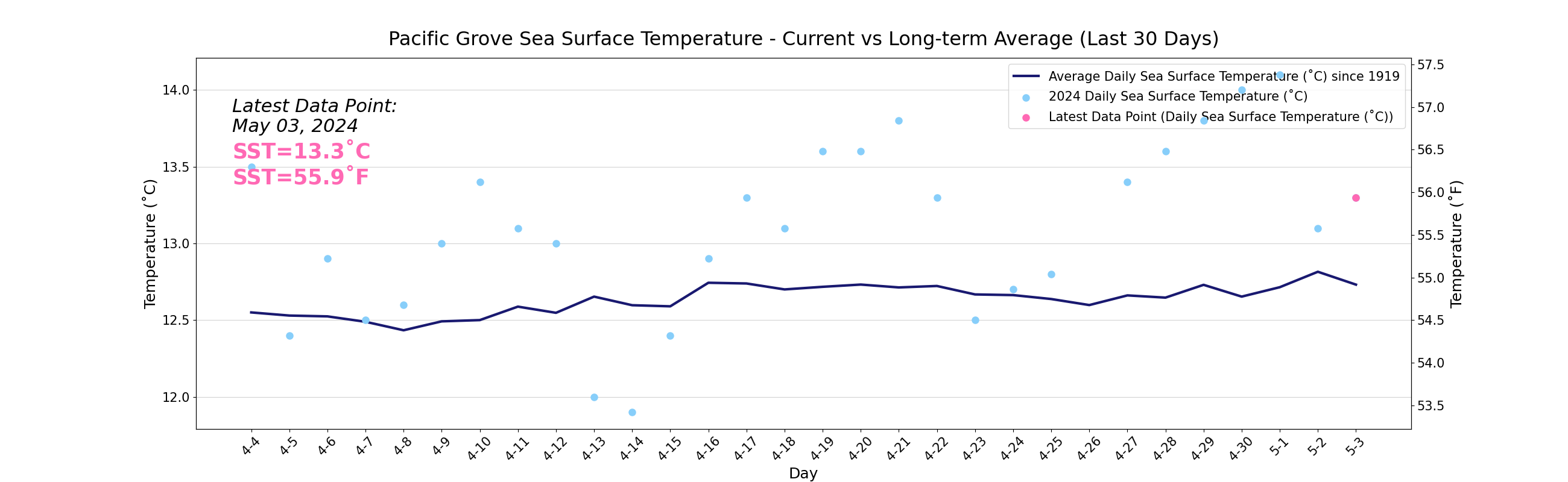
See how the daily temperature reading compares to the long term average:

Volunteer Betsy Mansfield retrieving a water sample at Pacific Grove for temperature measurements.
Staff from Stanford University’s Hopkins Marine Station take daily temperature measurements from a beach on the north side of Point Cabrillo just north of their main laboratory buildings. Exposed to the northwest swell as it sweeps past Point Piños, this location is representative of coastal conditions on the south side of Monterey Bay.
click here to access pacific grove data 1919-current
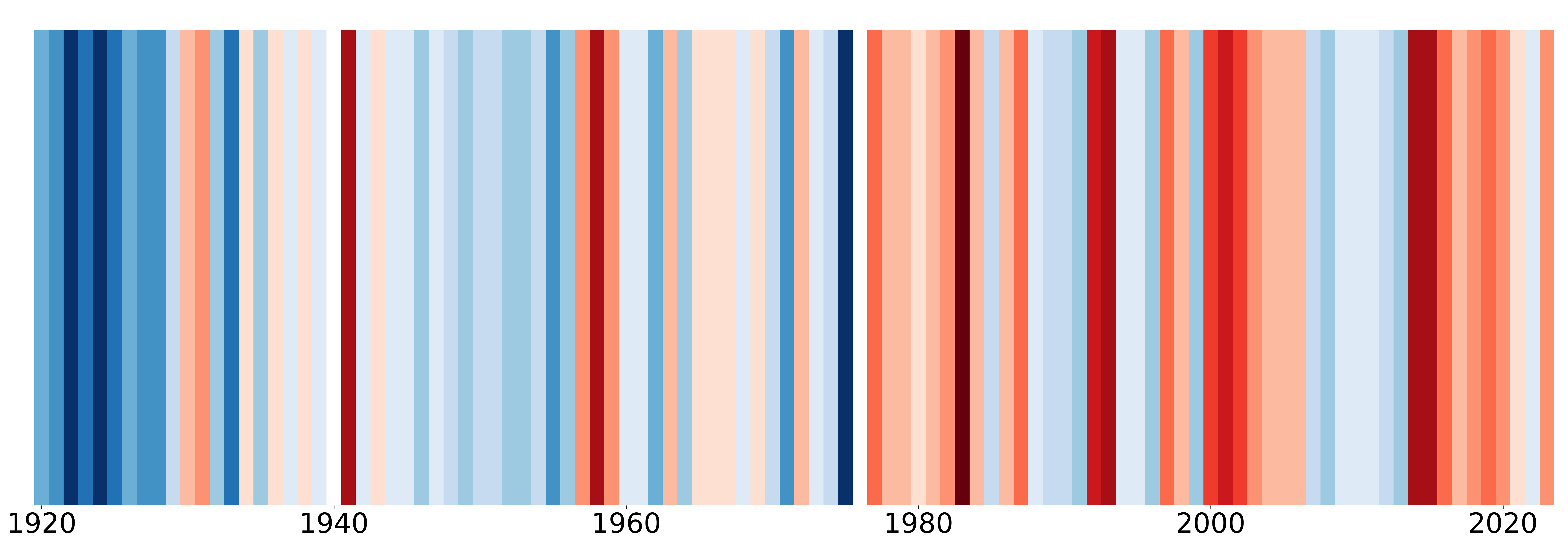
Below are figures that we have modeled after the #ShowYourStripes Campaign (created by Ed Hawkins), to help us visualize how sea surface temperature has changed at Pacific Grove since 1919. The change in temperature is relative to the average temperature calculated between 1919-2023.
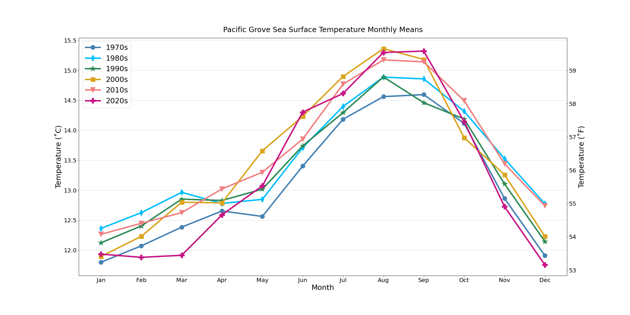
Below you can see a plot showing Monthly Sea Surface Temperature Averages from the Pacific Grove Shore Station, split up by decade, since 1970.
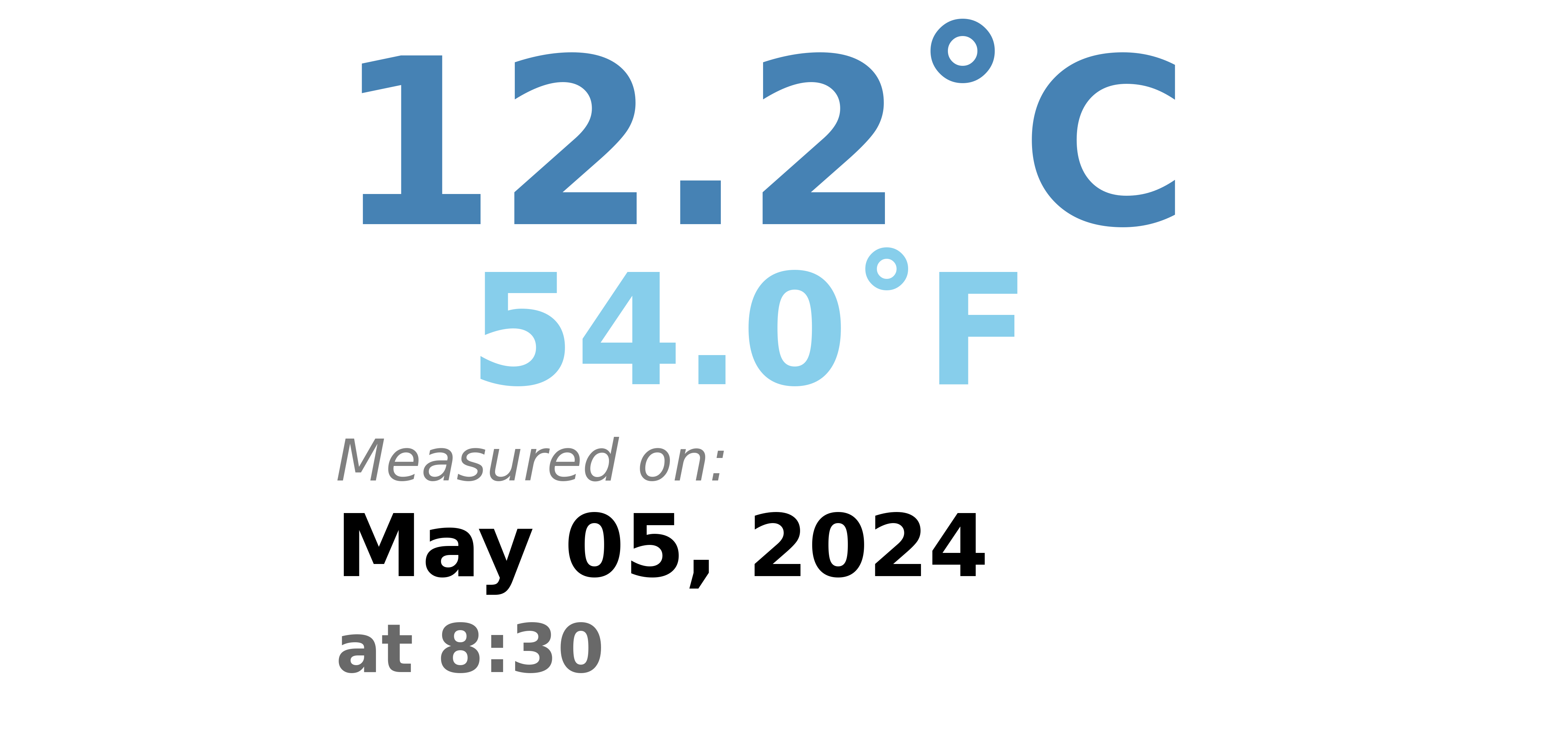
Recent Data
